Downtown Raleigh is the city's 1.5-square-mile Downtown Plan area, zoned mostly for Broughton High, with a typical 27601 home value of $497,314.
Last checked Oct. 12, 2026. Sources: the City of Raleigh’s 2030 Comprehensive Plan, area plan boundaries and Neighborhood Registry, the Wake County Public School System’s 2026-27 attendance areas, the N.C. Department of Public Instruction’s 2025-26 accountability data, GoRaleigh and GoTriangle schedule data, OpenStreetMap and Zillow Research.
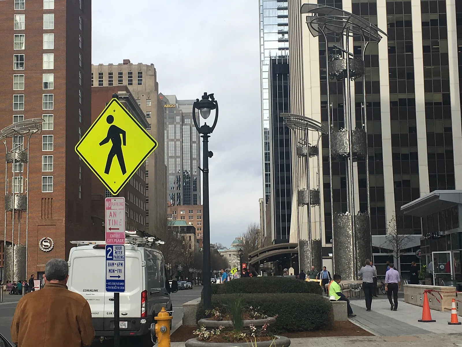
Downtown is Raleigh’s center: the State Capitol, Fayetteville Street, the office towers and, around them, apartment and condo districts. The city’s comprehensive plan says greater downtown covers more than 1,000 acres, roughly between Martin Luther King Jr. Boulevard on the south, Saint Mary’s School on the west, the industrial area along Capital Boulevard on the north, and the Historic Oakwood and East Raleigh neighborhoods on the east. At its center is the 400-acre street grid William Christmas laid out in 1792.
What this means for you
- Zoned high school: Broughton High for nearly all of downtown, 73.3% of state tests at grade level in 2025-26. Check an address with the district’s base school lookup.
- Home value: $497,314 in ZIP code 27601 in August 2026, according to the Zillow Home Value Index.
- Nearest freeway exit: Interstate 40 Exit 298 at South Saunders Street, about 2.5 miles by road.
Part of our Raleigh neighborhoods guide. More on what to do here in our downtown Raleigh guide.
Where it is
The boundary used on this page is the city’s Downtown Plan area, adopted Sept. 15, 2015, which covers about 1.5 square miles in the city’s area plan data. OpenStreetMap names several districts inside it, including Glenwood South, the Warehouse District, the Depot Historic District and Seaboard Station. The comprehensive plan lists Boylan Heights, Cameron Park, Glenwood-Brooklyn, Oakwood, Pullen and South Park among the historic neighborhoods at downtown’s edges.
We checked 16 points spread across the plan area against Census ZIP code areas: eight were in ZIP code 27601, seven in 27603 and one in 27605.
Schools
Downtown is in the Wake County Public School System, which assigns schools by address. We checked the same 16 points against the district’s 2026-27 attendance areas. Fifteen were zoned for Broughton High and one for Southeast Raleigh High. Ten were zoned for Oberlin Middle and four for Moore Square Middle. Elementary assignments were split, most often Wiley Elementary (nine points), then Joyner (three) and Conn (two). Check your own address in the base school lookup.
Scores are the share of state tests at grade level or above in 2025-26 and the state’s growth rating, from the accountability data.
| Level | School | At grade level | Growth |
|---|---|---|---|
| Elementary | Wiley Elementary | 68.6% | Exceeded |
| Elementary | Joyner Elementary | 69.5% | Not met |
| Middle | Oberlin Middle | 69.9% | Not met |
| Middle | Moore Square Middle, 301 S. Person St. | 75.9% | Not met |
| High | Broughton High, 723 Saint Marys St. | 73.3% | Exceeded |
The district average was 68.2%. More in our schools guide.
Home values
The Zillow Home Value Index is a modeled typical value for the middle third of homes, not a sale price. Zillow publishes no figure for downtown alone, so these are its ZIP code figures.
| Area | August 2026 | August 2025 | Change |
|---|---|---|---|
| ZIP code 27601 | $497,314 | $507,254 | -2.0% |
| ZIP code 27603 | $410,844 | $419,870 | -2.1% |
| City of Raleigh, for comparison | $428,671 | $436,286 | -1.7% |
Trends are on our home prices page.
Parks and trails
From the city’s park locator data:
- Moore Square, 201 S. Blount St., and Nash Square, 200 S. McDowell St., are city parks in the middle of downtown.
- John Chavis Memorial Park, 505 Martin Luther King Jr. Blvd., has a pool, a community center, tennis courts and greenway access, just south of the plan area.
- Dorothea Dix Park, 2105 Umstead Drive, lies southwest of downtown.
More in our parks and trails guide.
Getting around
- Interstate 40: Exit 298 at South Saunders Street is about 2.5 miles by road from the middle of downtown; Exit 300 at Rock Quarry Road is about 2.8 miles.
- Raleigh Municipal Building (222 W. Hargett St.): about 0.7 mile.
- Raleigh-Durham International Airport: about 14 miles by road.
- Buses: more than a dozen GoRaleigh routes stop at GoRaleigh Station on Blount Street, and stops on Wilmington and Salisbury streets serve routes including 1 (Capital Blvd), 2 (Falls of Neuse), 4 (Rex Hospital), 6 (Glenwood) and 8 (Six Forks). GoTriangle Route 100 stops downtown, and Route 305 stops at the Union Station bus platform, according to the agencies’ schedule data. See GoRaleigh and GoTriangle.
Distances were measured with the OSRM routing engine on OpenStreetMap roads. They are distances, not drive times. More in our getting around guide.
Groceries and everyday stores
OpenStreetMap lists these in or next to downtown:
- Supermarket: Publix, 417 W. Peace St.
- Pharmacies: Glenwood South Pharmacy & Market, 401 Glenwood Ave.; Person Street Pharmacy, 702 N. Person St.; Raleigh Pharmacy, 927 W. Morgan St.
- Shopping: City Market, and the Shops at Seaboard Station on the north side.
Homeowners and neighborhood groups
The city’s Neighborhood Registry lists 15 groups inside the Downtown Plan area. The largest by homes counted are the Glenwood South Neighborhood Collaborative (3,033), West Morgan Neighborhood Association (740), Hudson and Plaza Neighborhood Association (706) and Warehouse District Community Association (600). Several condominium and homeowners associations are also listed, among them the Cotton Mill HOA and the Quorum condominium association.
How we built this page
The boundary is the city’s adopted Downtown Plan area. ZIP codes and school zones were checked at 16 points spread across it; a home near a zone line can differ. Parks come from the city’s data and stores from OpenStreetMap.
Frequently asked questions
What high school is downtown Raleigh zoned for?
Fifteen of 16 points we checked across the city’s Downtown Plan area were zoned for Broughton High in the Wake County Public School System’s 2026-27 attendance areas; one was zoned for Southeast Raleigh High.
What ZIP code is downtown Raleigh?
Most of downtown is in ZIP code 27601, with the south and west parts in 27603 and a small part in 27605.
What is the typical home value in downtown Raleigh?
The Zillow Home Value Index for ZIP code 27601 was $497,314 in August 2026, down 2.0% from a year earlier. The figure for the whole city was $428,671.
How far is downtown Raleigh from RDU airport?
About 14 miles by road from the middle of downtown to Raleigh-Durham International Airport, measured on OpenStreetMap roads.
Have your say