The New Bern Avenue area runs east from downtown Raleigh, mostly in ZIP code 27610, where the typical home value was $313,331 in August 2026.
Last checked Oct. 12, 2026. Sources: the City of Raleigh’s 2030 Comprehensive Plan, area plan boundaries and Neighborhood Registry, the Wake County Public School System’s 2026-27 attendance areas, the N.C. Department of Public Instruction’s 2025-26 accountability data, GoRaleigh and GoTriangle schedule data, OpenStreetMap and Zillow Research.
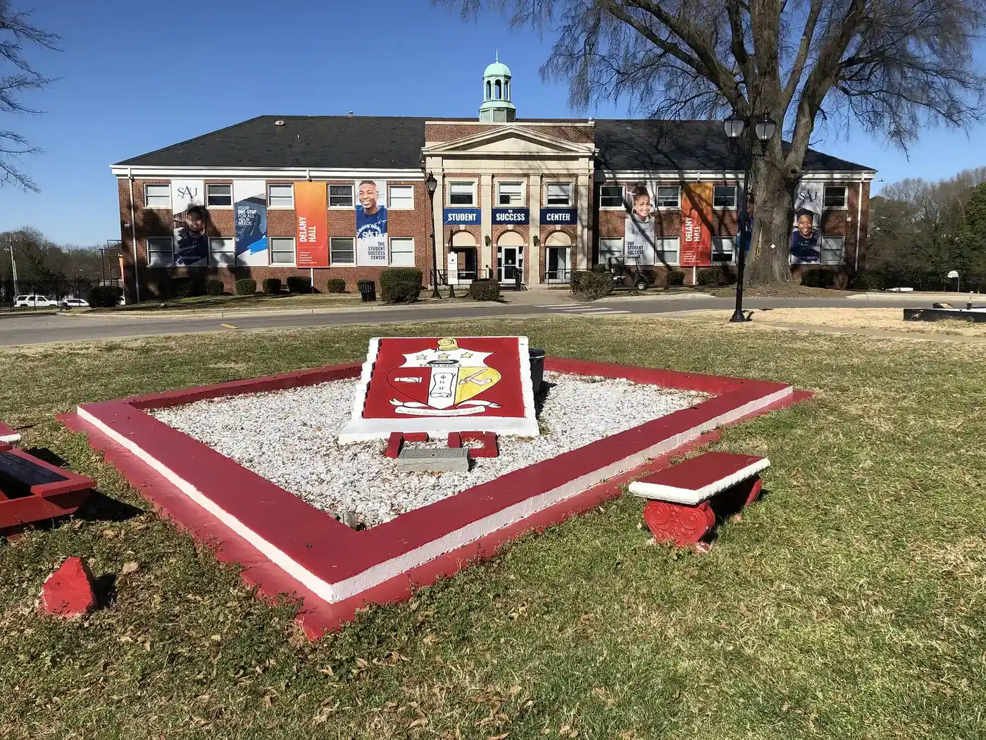
New Bern Avenue runs east from downtown Raleigh through east Raleigh toward I-440 and WakeMed. The city’s New Bern Avenue station area plan, adopted Jan. 30, 2024, covers the neighborhoods on both sides of the road, about 5.1 square miles, and replaced the older King Charles, New Bern Avenue and Olde East Raleigh plans. Saint Augustine’s University and Enloe High School are inside it.
What this means for you
- Zoned high school: split by address among Enloe High (76.1% of state tests at grade level in 2025-26), Broughton High and Millbrook High. Check an address with the district’s base school lookup.
- Home value: $313,331 in ZIP code 27610 in August 2026, according to the Zillow Home Value Index.
- Nearest freeway exit: Interstate 40 Exit 300 at Rock Quarry Road, about 2 miles by road; I-440 Exit 13 at New Bern Avenue is about 2.3 miles.
Part of our Raleigh neighborhoods guide.
Where it is
The plan area in the city’s area plan data stretches from the east edge of downtown, including Historic Oakwood, east along New Bern Avenue toward the Beltline. The city’s comprehensive plan says the plan is about growing around transit investments on New Bern Avenue: allowing more housing and jobs along the road, keeping housing available at a wide range of incomes, investing in walking routes to transit stations, supporting small businesses, and telling the story of the Black neighborhoods along New Bern Avenue through art, community spaces and partnerships with institutions such as Saint Augustine’s University. It directs 20% to 40% of city housing bond money to the corridor until at least 2032.
Of 16 points we checked across the plan area, 12 were in ZIP code 27610, two in 27601 and two in 27604.
Schools
The area is in the Wake County Public School System, and assignments vary block by block. Of the 16 points we checked in the district’s 2026-27 attendance areas, six were zoned for Enloe High, five for Broughton High, three for Millbrook High and one each for Southeast Raleigh High and Knightdale High. Middle school assignments were split among Durant Road (five points), Moore Square (four), Ligon (three) and others; elementary assignments among 11 schools, most often Wilburn Elementary (four). Check your own address in the base school lookup.
Scores are the share of state tests at grade level or above in 2025-26 and the state’s growth rating, from the accountability data.
| Level | School | At grade level | Growth |
|---|---|---|---|
| Elementary | Wilburn Elementary, 3707 Marsh Creek Road | 39.2% | Exceeded |
| Elementary | Hunter Elementary, 1018 E. Davie St. | 77.5% | Met |
| Middle | Durant Road Middle | 49.2% | Met |
| Middle | Moore Square Middle, 301 S. Person St. | 75.9% | Not met |
| Middle | Ligon Middle, 706 E. Lenoir St. | 65.2% | Not met |
| High | Enloe High, 128 Clarendon Crescent | 76.1% | Met |
| High | Broughton High, 723 Saint Marys St. | 73.3% | Exceeded |
| High | Millbrook High, 2201 Spring Forest Road | 63.2% | Met |
The district average was 68.2%. More in our schools guide.
Home values
The Zillow Home Value Index is a modeled typical value for the middle third of homes, not a sale price. Zillow publishes no figure for the corridor alone.
| Area | August 2026 | August 2025 | Change |
|---|---|---|---|
| ZIP code 27610 | $313,331 | $321,434 | -2.5% |
| ZIP code 27604 | $337,619 | $347,374 | -2.8% |
| ZIP code 27601 | $497,314 | $507,254 | -2.0% |
| City of Raleigh, for comparison | $428,671 | $436,286 | -1.7% |
Trends are on our home prices page.
Parks and trails
From the city’s park locator data:
- Longview Park, 321 Bertie Drive, with a pool.
- Fisher Street Park, 324 N. Fisher St., with a playground.
- Pender Street Park, 1600 Pender St.
- Roberts Park, 1300 E. Martin St., with a playground, a community center and tennis courts.
- Tarboro Road Park, 121 N. Tarboro St., with a community center and tennis courts.
- Lions Park, 516 Dennis Ave.
More in our parks and trails guide.
Getting around
- Interstate 40: Exit 300 at Rock Quarry Road is about 2 miles by road from the middle of the corridor.
- Interstate 440: Exit 13 at New Bern Avenue is about 2.3 to 2.5 miles.
- Raleigh Municipal Building (222 W. Hargett St.): about 2.3 miles.
- Raleigh-Durham International Airport: about 20 miles by road.
- Buses: GoRaleigh Route 15 (WakeMed) runs on New Bern Avenue, with stops at Bertie Drive and North King Charles Road. Route 10 (Longview) runs on Oakwood Avenue and Route 18 (Poole-Barwell) on Poole Road. GoTriangle’s ZWX express stops on New Bern Avenue at South Tarboro Road and at WakeMed, according to the agencies’ schedule data. See GoRaleigh and GoTriangle.
Distances were measured with the OSRM routing engine on OpenStreetMap roads. They are distances, not drive times. More in our getting around guide.
Groceries and everyday stores
OpenStreetMap lists these in or next to the area:
- Groceries: Larry’s Supermarket, 2041 Milburnie Road; Black Farmers Hub, 1409 Cross St.; Food Lion, 3685 New Bern Ave.
- Pharmacies: Josef’s Pharmacy, 2100 New Bern Ave.; Walgreens, 3101 New Bern Ave.
- Shopping: Raleigh Boulevard Plaza and the Tower Shopping Center.
Homeowners and neighborhood groups
The city’s Neighborhood Registry lists 16 groups inside the plan area. The largest by homes counted are the Longview Neighbors Association (675), the Thompson-Hunter Neighborhood Association (652), the Oakwood Garden Club (625), the Idlewild Community Association (336), E Martin Street Group (273) and the Battery Heights Neighborhood Association (231). Several homeowners associations are also listed, among them the Village at Beacon Hill HOA (186 homes) and Victoria Place HOA (92).
How we built this page
The boundary is the city’s adopted New Bern Avenue station area plan. ZIP codes and school zones were checked at 16 points spread across it; school assignments here vary closely by address, so use the district’s lookup for any specific home.
Frequently asked questions
What high school is the New Bern Avenue area zoned for?
It depends on the address. Of 16 points we checked across the city’s New Bern Avenue plan area, six were zoned for Enloe High, five for Broughton High and three for Millbrook High in the Wake County Public School System’s 2026-27 attendance areas.
What ZIP code is New Bern Avenue in Raleigh?
Most of the plan area is in ZIP code 27610; the west end near downtown is in 27601 and the north side in 27604.
What is the typical home value along New Bern Avenue?
The Zillow Home Value Index for ZIP code 27610 was $313,331 in August 2026, down 2.5% from a year earlier. The citywide figure was $428,671.
What is the New Bern Avenue station area plan?
It is the city’s plan, adopted Jan. 30, 2024, for growth around transit investments along New Bern Avenue, with more housing and jobs, housing for a wide range of incomes, walking routes to transit stations and support for small businesses.
Have your say